
Everything You Need to Know About El Camino de Costa Rica
Everything You Need to Know About El Camino de Costa Rica
El Camino de Costa Rica is a 280-kilometer (174-mile) hiking trail that crosses the country from coast to coast — from the Caribbean Sea to the Pacific Ocean. Along the way, it climbs through cloud forest, drops into coffee country, crosses an Indigenous territory, and passes through more than two dozen rural communities that depend on hikers like you for a meaningful share of their income. It's not a wilderness trek in the backcountry sense. Most nights you'll sleep in a family's home, a small community lodge, or a simple campsite, and most days you'll share the trail with farmers, schoolchildren, and the occasional howler monkey. If you're considering it, here's everything you need to know — the history, the route, the culture, the wildlife, and the practical details for planning your own hike.
Quick Facts
- Length: 280 km (174 miles)
- Stages: 16 official stages
- Duration: Typically 12–16 days, depending on pace
- Start: Parismina (Caribbean coast)
- Finish: Quepos (Pacific coast)
- Elevation range: Sea level to roughly 2,333 m (7,654 ft) at El Empalme
- Total elevation gain: Approximately 7,250 m (24,000 ft) over the full route
- Climate zones crossed: 6
- Best season: Dry season, December–April
- Communities along the route: 25
- Biodiversity: Over 9,000 plant species, ~900 bird species (including 50 hummingbird species), and around 400 native bee species
The Story Behind the Trail
El Camino de Costa Rica traces its roots to 2011, when Conchita Espino and her husband Marco Marín — fresh off completing the Camino de Santiago in Spain — retired to Costa Rica with an idea: build a long-distance trail of similar ambition, coast to coast, that hikers from around the world would want to complete at least once in their lives.
The following year, a small group of pioneers — Marco Marín, Juan Tuinstra, Juancho Chavarría, Rigoberto Venegas, and Andrea Lizano among them — began tracing a route on foot. By 2015, that effort had grown into the Asociación Mar a Mar, the nonprofit that designed, built, and continues to manage the trail today, alongside a broader mission of conservation and rural development.
The trail formally opened in 2018, the same year Costa Rica's president declared it of National and Public Interest for aligning with the country's low-carbon, climate-resilient development goals. Since then it's grown steadily: route markers and signage installed community by community, a hiking guidebook published and later updated, a ceremonial Cabécar cultural center built in partnership with local communities, and in 2024, both inclusion in the FarOut navigation app and formal legislative recognition of the trail's tourism development as a matter of public interest.
What started as one couple's idea is now a working piece of infrastructure for 25 rural communities — something hikers help sustain every time they book a night's stay or sit down for a meal along the way.
Where the Trail Goes
The hike begins on the Caribbean side, in the small town of Parismina.
From there, the route heads inland and climbs. It crosses the Nairi-Awari Indigenous Territory, home to the Cabécar people, where a local guide is required by law to pass through. It fords the Pacuare River, skirts the edge of Tapantí National Park, and descends into the Orosi Valley before climbing to its highest point — roughly 2,333 meters (7,654 feet) — near the community of El Empalme, with the Turrialba and Irazú volcanoes visible across long stretches of trail.
From the highlands, the trail winds through the coffee country of Tarrazú and the Los Santos zone before descending toward the Pacific. It ends in Quepos, where you will meet the Pacific ocean and complete the journey.
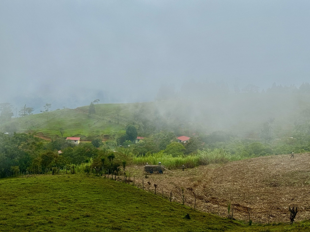
Along the way, the trail passes through six distinct climate zones: hot coastal lowlands lined with banana, pineapple, and oil palm plantations; dense primary rainforest; wide cattle ranches and sugar cane fields; and the cool, high-altitude coffee farms of the central highlands. The terrain shifts just as often — narrow forest singletrack, dirt farm roads, gravel, the occasional stretch of pavement — which is part of what makes it a genuinely varied trek rather than a single repeated landscape for 280 kilometers.
A Trail With a Mission
The trail exists because of a specific, well-documented gap: by 2018, Costa Rica's rural population had been shrinking for nearly two decades, rural poverty sat noticeably higher than urban poverty, and rural household income lagged by more than 40%. Meanwhile, the country's tourism boom was concentrated almost entirely on its coasts — places like Limón and Quepos saw the benefit, while the small towns in between saw very little of it.
Asociación Mar a Mar built El Camino de Costa Rica as a direct response to that imbalance. The idea is straightforward: route a world-class long-distance trail directly through the rural towns tourism usually skips, and let hikers' spending — on lodging, meals, guides, and local goods — flow straight into those local economies.
It's working. By the end of the trail's first year, six communities along the route reported a 30% increase in tourism-driven income. Today, Mar a Mar works with 25 communities, and since 2016 has facilitated more than 40 community infrastructure improvements, supported 23 rural entrepreneurships, and trained 53 women entrepreneurs across 13 communities — alongside ongoing reforestation, potable water, and connectivity projects. More than 90% of donations to Mar a Mar go directly to these trail and community projects.
This is also why most accommodations along El Camino aren't hotels — they're homes, family-run hostels, and small campsites. Staying in them isn't just part of the experience; it's the actual mechanism by which the trail does what it's designed to do.
Wildlife and Plant Life Along the Way
Costa Rica holds an outsized share of the planet's biodiversity, and El Camino de Costa Rica crosses a genuine cross-section of it — over 9,000 plant species, roughly 900 bird species, around 250 mammal species, and an estimated 400 native bee species, among many others.
What you're likely to see:
- Monkeys and sloths — the most commonly spotted mammals, especially in Sections 1, 2, 12, and 16
- Birds — including the resplendent quetzal and scarlet macaws; the trail is also home to a large share of Costa Rica's 50 hummingbird species, concentrated especially in Sections 12 and 13
- Reptiles and amphibians — red-eyed tree frogs, poison dart frogs, and occasionally a fer-de-lance, best (and safely) observed at a distance with an experienced guide
- Native bees — Mar a Mar runs a native and solitary bee program across at least six communities, with bee-focused tours available in some sections
Ecosystems you'll pass through range from primary rainforest and cloud forest to mangroves and agricultural landscapes — coffee, banana, and sugar cane among them. The trail borders or passes directly through several protected areas, including Barbilla National Park and Tapantí National Park, both important habitat for the region's biodiversity.
When to Go and What to Expect
Best time to hike: The dry season, December through April, offers the most predictable weather — though "dry" is relative in a tropical country, and rain gear is non-negotiable year-round.
Climate: Expect temperatures anywhere from 8°C (46°F) in the highlands to 35°C (95°F) on the coasts — sometimes within the same week. Strong sun and sudden, heavy rain can both show up on the same day, so plan for both.
Terrain and fitness: This isn't a technical climb, but it is a long-distance trek with real elevation change — nearly 7,250 meters (24,000 feet) of cumulative gain across the full route. Good general fitness and some multi-day hiking experience will serve you well. Footwear is a matter of preference; both trail runners and sturdy boots are common choices among hikers who've completed it.
Packing List
A few essentials, drawn from what experienced hikers and Mar a Mar itself recommend:
- Sun protection: sunscreen, hat, long-sleeve shirt
- Rain protection: waterproof jacket, poncho, and (seriously) an umbrella
- Light, fast-drying hiking clothes plus a light warm layer for higher elevations
- Hiking footwear of your choice, plus lightweight camp shoes (Crocs or similar) for evenings and river crossings
- Insect repellent and a basic first-aid kit
- A phone charger with a Type A adapter if you're not coming from North or Central America
- Any prescription medication you need — specialty medicine can be hard to find outside major towns
- A reusable water container and a water filter or treatment method
- Trekking poles and gaiters, if you typically hike with them
- A few extra pairs of socks
You can read our full packing list here.
Money and Logistics
Almost all the lodgings along the trail don't accept credit cards, so plan to carry cash. Only two ATMs exist along the entire route, so withdraw what you need before setting out and avoid carrying it all at once.
The average hiker spends $1100 on this hike. You can learn more about what this looks like here.
Because most accommodations are private homes or small family-run lodges, reservations matter. Hosts generally ask for 1–2 weeks' notice, and WhatsApp is the standard way to reach them. Using this website, reservations are simple to request as the reservation message is automatically generated and sent. You can then manage the bookings in our itinerary builder, keeping your stays organized and easy to follow.
Navigating the route
The trail is marked with an official blazing system: a 2-inch by 6-inch red vertical stripe at intersections and decision points, along with wooden directional signs bearing a red hummingbird emblem wherever a change of direction is required. You'll also pass mojones — concrete markers, one per stage — along with occasional government-installed (ICT) signage showing distance to either endpoint.
In addition to this, using the FarOut navigational app is very handy and works well.
Two Stretches That Require a Guide
Two sections of the trail cross private land where a guide isn't optional — it's required for passage:
- Stage 3 and 4, Nairi-Awari Indigenous Section: A local Cabécar guide must be arranged in advance.
- The end of Stage 4, Ganadería Tres Equis: An active cattle ranch where the landowner requires a guide for safety reasons.
Most hikers complete both parts in a single day, and can hire one guide to cover the full stretch, which saves you the cost and coordination of hiring twice.
Self-Guided vs. Guided
You can hike El Camino de Costa Rica either way, and plenty of people do both successfully.
Self-guided gives you full control over pace, rest days, and where you wish to stay. It also means handling your own navigation, reservations, and logistics — manageable but another step.
Guided trips, run by local tour operators, handle logistics for you and can be a good fit if you'd rather focus entirely on the walking and the experience, or if you're short on planning time.
Where You'll Stay
Lodging along El Camino reflects the trail's whole purpose: it's almost entirely community-based. Across the route you'll find a mix of homestays, small family-run hotels, lodges, and campsites. At almost all locations they will provide dinner and breakfast as well - simplifying the planning process and what you need to carry on the trail.
Because these are real homes and small operations, not hotels with front desks, advance reservations matter more here than on most trails.
Trail Stages
We are building out short guides to all trail stages, which are linked below. Summary information is as follows:
- Stage 1A | 30.9 kms (most covered by boat), flat.
- Stage 1B | 23.7 kms, flat.
- Stage 2 | 16.7 kms, hiking up.
- Stage 3 | 11.6 kms, difficult jungle terrain
- Stage 4 | 6.4 kms, challenging jungle terrain and a river crossing. Often combined with Stage 3.
- Stage 5 | 13.2 kms, moderate climbing.
- Stage 6 | 12.5 kms, 371 meters of climbing and then a long downhill
- Stage 7 | 20.6 kms, some up and down and then you follow the Pejibaye River.
- Stage 8
- Stage 9
- Stage 10
- Stage 11
- Stage 12
- Stage 13
- Stage 14
- Stage 15
- Stage 16
Final Thoughts
El Camino de Costa Rica is a genuinely varied trek: dense jungle, steep climbs, and small rural communities along the way. Whether you hike it in one continuous push or break it into stages over multiple trips, you'll come away with a closer look at rural Costa Rica than almost any other way of visiting the country offers.